
| Pinners Point Interchange Construction Photos - September 2005 |
Here are 60 photos of the Pinners Point Interchange (Port Norfolk Connector) project under construction, taken by the Roads to the Future author on September 10, 2004. Click the thumbnail photo for a larger photo (they range in size from 92 to 314 kilobytes, with most being less than 205 kilobytes).
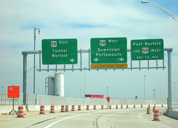
| The following 14 photos comprise in order a drive eastbound from the west end of the project on VA-164 to the south end of the project on the MLK Freeway. | |
 |
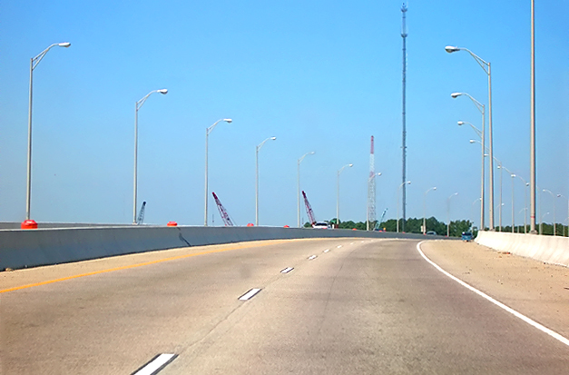
VA-164 Western Freeway, eastbound, approaching the West Norfolk Bridge. The 4-lane freeway had been temporarily reduced to 2-lane 2-way traffic on one roadway, with the other roadway temporarily closed, during the construction, and the bridge and freeway was reopened to the full 4 lanes in early August. |
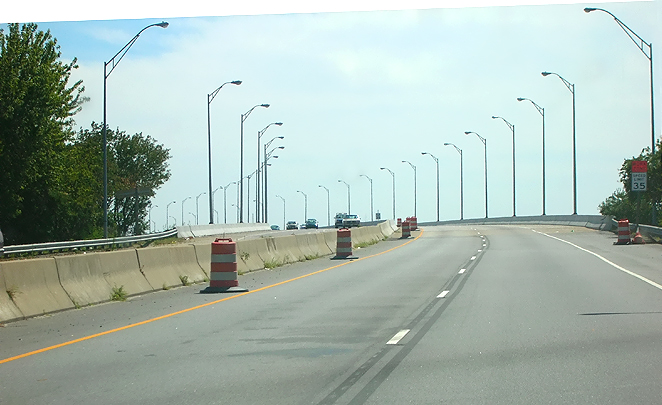 |
VA-164 Western Freeway, eastbound, approaching the West Norfolk Bridge. |
 |
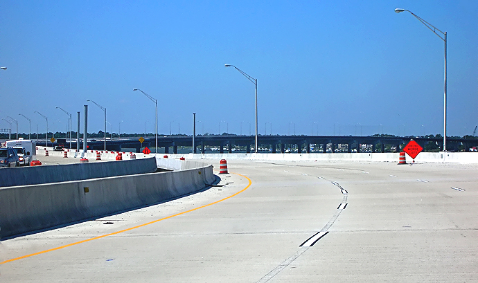
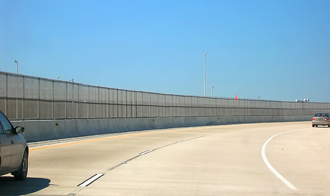
VA-164 West Norfolk Bridge, heading eastward toward the east end of the bridge. The eastern 1,200 feet of the 3,630-foot-long West Norfolk Bridge has been reconstructed and realigned slightly northward so that it makes a seamless freeway connection with the new Port Norfolk Connector bridge. The seam between the original and new bridge construction, is visible ahead near where the two cars are. The extended West Norfolk Bridge is 5,930 feet long. |
 |
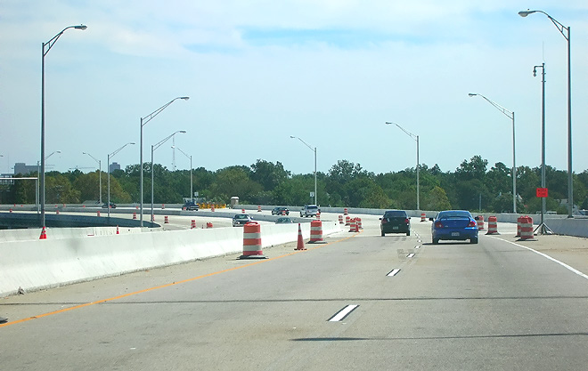
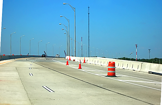
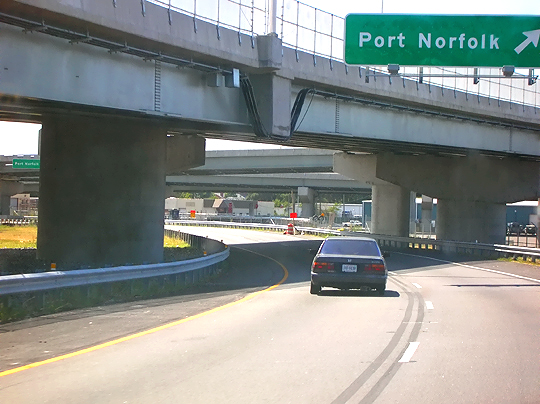
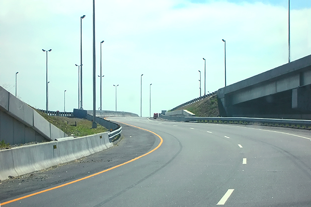
Extension of the VA-164 West Norfolk Bridge, the Port Norfolk Connector bridge, open to traffic with 2 lanes each way, driving eastbound, just entered the new extended section of the bridge, which will have 3 lanes each way after the barrels are removed. The Port Norfolk neighborhood is to the right. |
 |
Extension of the VA-164 West Norfolk Bridge, the Port Norfolk Connector bridge, open to traffic with 2 lanes each way, driving eastbound, just entered the new extended section of the bridge, which will have 3 lanes each way after the barrels are removed. A telephoto lens exaggerates the curvature of the highway, as it is easily drivable at 45 mph. |
 |
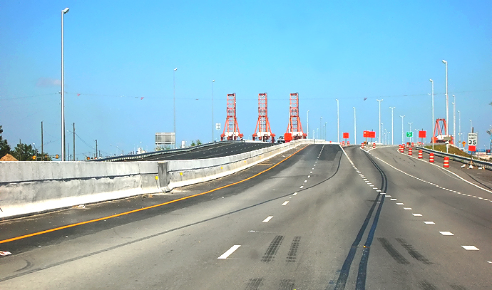
Extension of the VA-164 West Norfolk Bridge, the Port Norfolk Connector bridge, open to traffic with 2 lanes each way, driving eastbound, on the new extended section of the bridge, which will have 3 lanes each way after the barrels are removed. The Elizabeth River is visible to the left, and Norfolk is on the opposite side of the river. |
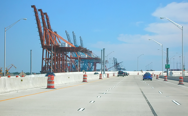 |
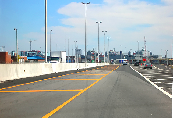
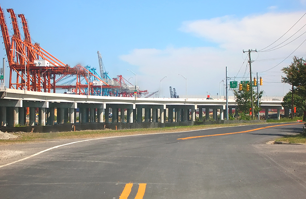
Extension of the VA-164 West Norfolk Bridge, the Port Norfolk Connector bridge, open to traffic with 2 lanes each way, driving eastbound, on the new extended section of the bridge, which will have 3 lanes each way after the barrels are removed. The gantries at the Portsmouth Marine Terminal are visible ahead. |
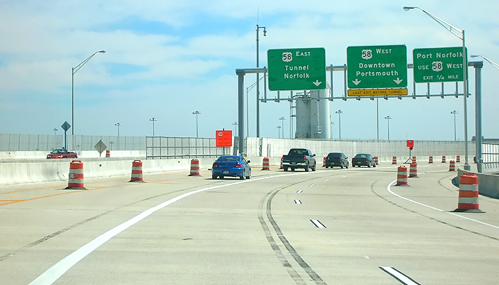 |
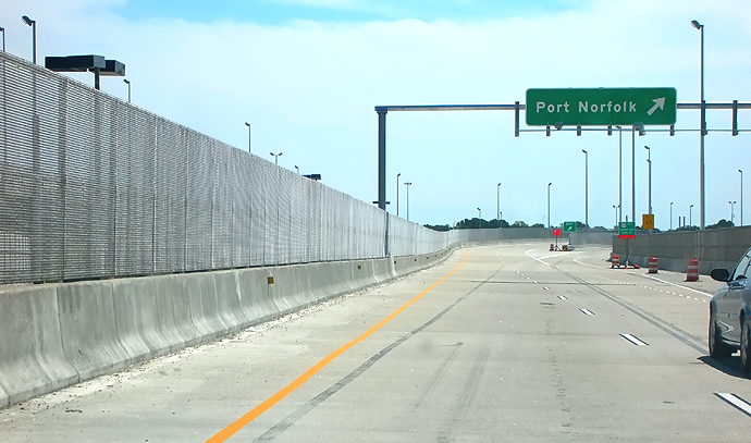
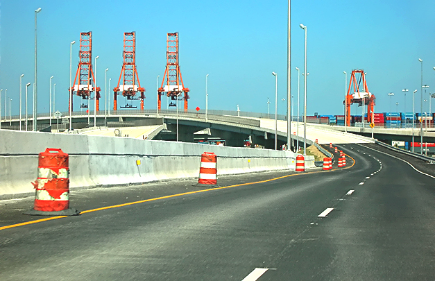
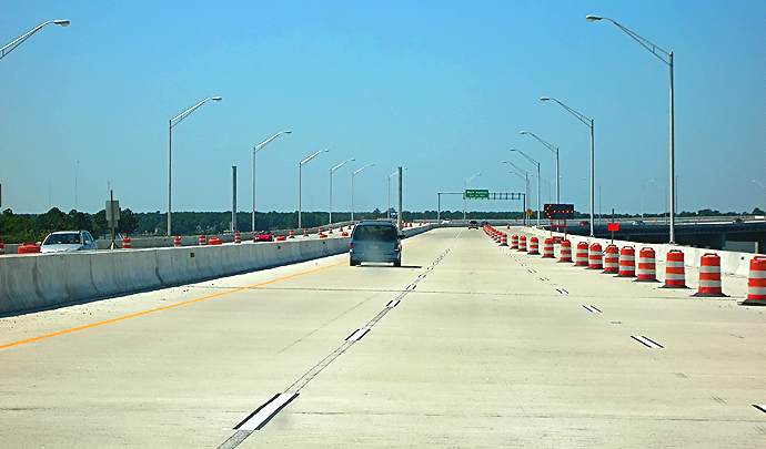
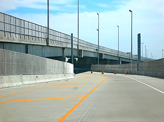
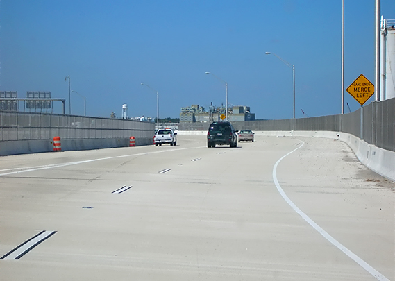
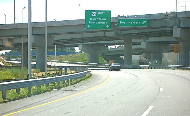
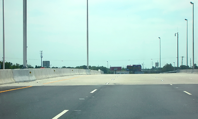
Extension of VA-164, driving eastbound, approaching the Portsmouth Marine Terminal, approaching the point where the completed 4-lane eastbound VA-164 roadway will split into a 2-lane roadway to the Midtown Tunnel and a 2-lane roadway to the US-58 MLK Freeway southbound. The high chain link fencing is on the bridge sections that pass over the marine terminal. |
 |
Extension of VA-164, driving eastbound, approaching the Portsmouth Marine Terminal, approaching the point where the completed 4-lane eastbound VA-164 roadway splits into a 2-lane roadway to the Midtown Tunnel and a 2-lane roadway to the US-58 MLK Freeway southbound. The high chain link fencing is on the bridge sections that pass over the marine terminal. |
 |
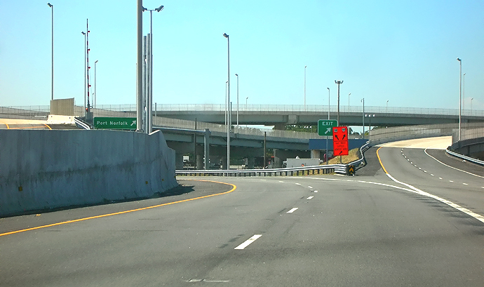
Pinners Point Interchange, driving eastbound, passing over the Portsmouth Marine Terminal, at the section where the 4-lane eastbound VA-164 roadway splits into a 2-lane roadway to the Midtown Tunnel and a 2-lane roadway to the US-58 MLK Freeway southbound. The 2-lane roadway to the Midtown Tunnel, has the left lane closed via yellow paint lines. The two Pinners Point Interchange directional ramps to the Midtown Tunnel approach highway, are each two lanes wide but have permanent line painting for one lane, since all that merges into one northbound lane through the tunnel; and those second lanes on those ramps will remain closed until the parallel Midtown Tunnel is built in the future. |
 |
Pinners Point Interchange, driving southbound, passing over the Portsmouth Marine Terminal, on the 2-lane roadway from the VA-164 Western Freeway to the US-58 MLK Freeway southbound. The local offramp to Cleveland Street in Port Norfolk, is ahead. |
 |
Pinners Point Interchange, driving southbound, on the 2-lane roadway from the VA-164 Western Freeway to the US-58 MLK Freeway southbound. The 2-lane roadway from the Midtown Tunnel to the MLK Freeway, merges into this roadway, ahead. |
 |
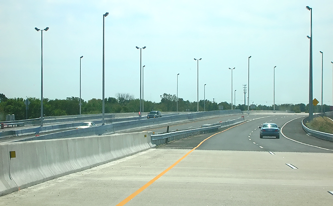
Martin Luther King Freeway, 4 lanes southbound, after the merge between the VA-164 Western Freeway and the Midtown Tunnel approach highway. The MLK Freeway southbound tapers to 3 lanes as it heads to VA-141 London Boulevard. |
 |
Martin Luther King Freeway, 4 lanes southbound, after the merge between the VA-164 Western Freeway and the Midtown Tunnel approach highway. The MLK Freeway southbound tapers to 3 lanes as it heads to VA-141 London Boulevard. |
| The following 14 photos comprise in order a drive northbound and then westbound from the south end of the project on the MLK Freeway northbound, to the west end of the project on VA-164. | |
 |
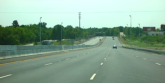
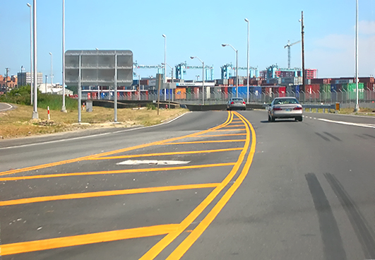
Martin Luther King Freeway, driving northbound, just north of VA-141 London Boulevard. The 4-lane MLK Freeway has been reconstructed to 6 lanes (3 each way), with a concrete median barrier, and a sound barrier on the right. The gantries at the Portsmouth Marine Terminal are visible ahead. |
 |
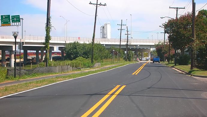
Martin Luther King Freeway, driving northbound, approaching the Cleveland Street interchange, where the MLK Freeway passes on a bridge over Cleveland Street. The 4-lane MLK Freeway has been reconstructed to 6 lanes, with a concrete median barrier. After the hillcrest, The MLK Freeway northbound splits, with the 2 right lanes heading to the Midtown Tunnel, and with the 2 left lanes heading to the VA-164 Western Freeway. |
 |
VA-164
driving northbound in the Pinners Point Interchange, on the 2-lane roadway
that connects the MLK Freeway northbound to the VA-164 Western Freeway
westbound.
|
 |
VA-164 driving northbound in the Pinners Point Interchange, on the 2-lane roadway that connects the MLK Freeway northbound to the VA-164 Western Freeway westbound. This ramp is easily drivable at 45 mph. |
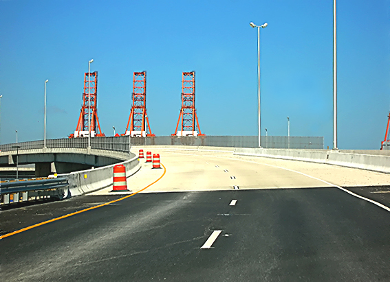 |
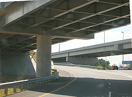
VA-164 driving northbound in the Pinners Point Interchange, on the 2-lane roadway that connects the MLK Freeway northbound to the VA-164 Western Freeway westbound. The bridged roadway ahead is the top level of the 3-level interchange, and it passes over the Portsmouth Marine Terminal. |
 |
VA-164 driving northbound in the Pinners Point Interchange, on the 2-lane roadway that connects the MLK Freeway northbound to the VA-164 Western Freeway westbound. The high chain link fencing is on the bridge sections that pass over the marine terminal. |
 |
VA-164 driving northbound in the Pinners Point Interchange, on the 2-lane roadway that connects the MLK Freeway northbound to the VA-164 Western Freeway westbound. Visible ahead is the merge section for the 2-lane roadway that connects the Midtown Tunnel approach highway southbound to the VA-164 Western Freeway westbound. |
 |
Extension of the VA-164 West Norfolk Bridge, the Port Norfolk Connector bridge, open to traffic with 2 lanes each way, which will have 3 lanes each way after the barrels are removed; driving westbound. |
 |
Extension of the VA-164 West Norfolk Bridge, the Port Norfolk Connector bridge, open to traffic with 2 lanes each way, which will have 3 lanes each way after the barrels are removed; driving westbound. |
 |
Extension of the VA-164 West Norfolk Bridge, the Port Norfolk Connector bridge, open to traffic with 2 lanes each way, which will have 3 lanes each way after the barrels are removed; driving westbound. |
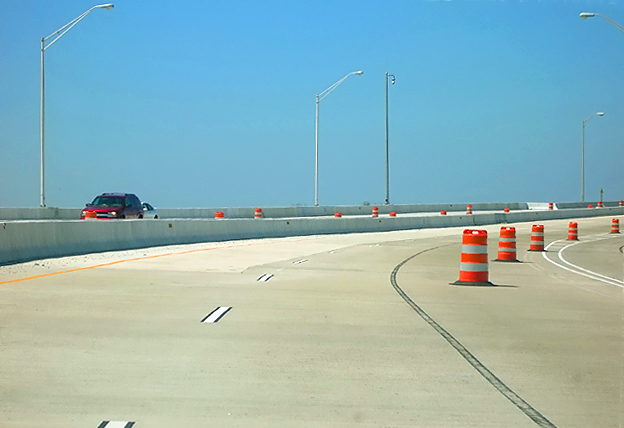 |
Extension of the VA-164 West Norfolk Bridge, the Port Norfolk Connector bridge, open to traffic with 2 lanes each way, which will have 3 lanes each way after the barrels are removed; driving westbound. |
 |
Extension of the VA-164 West Norfolk Bridge, the Port Norfolk Connector bridge, open to traffic; driving westbound. Bayview Boulevard is the waterfront road in the Port Norfolk neighborhood, and a pedestrian/bicycle trail was built alongside the road as part of this project, and the pedestrian/bicycle trail has a bridge to the West Norfolk Bridge so that pedestrians and bicyclists can utilize the north shoulder of the bridge to cross the river. The area striped with white lines on the right, is the pedestrian/bicycle trail. |
 |
VA-164 West Norfolk Bridge, the original 4-lane (2 each way) bridge; driving westbound. The bridge crosses the Elizabeth River Western Branch. |
 |
VA-164 West Norfolk Bridge, the original 4-lane (2 each way) bridge; the west end of the bridge is visible ahead, driving westbound. |
| The following 7 photos comprise in order a drive eastbound from the VA-164 Western Freeway to the Midtown Tunnel. | |
 |
Extension of VA-164 Western Freeway, open to traffic with one lane of traffic on the 2-lane bridged roadway that connects eastbound VA-164 to the Midtown Tunnel approach highway (US-58 MLK Freeway). The 2-lane roadway to the Midtown Tunnel, has the left lane closed via yellow paint lines. The two Pinners Point Interchange directional ramps to the Midtown Tunnel approach highway, are each two lanes wide but have permanent line painting for one lane, since all that merges into one northbound lane through the tunnel; and those second lanes on those ramps will remain closed until the parallel Midtown Tunnel is built in the future. |
 |
Extension of VA-164 Western Freeway, open to traffic with one lane of traffic on the 2-lane bridged roadway that connects eastbound VA-164 to the Midtown Tunnel approach highway (US-58 MLK Freeway). This ramp is easily drivable at 45 mph. The high chain link fencing is on the bridge sections that pass over the marine terminal. The overpassing bridged roadway is the top level of the 3-level Pinners Point Interchange, the 2-lane roadway ramp that connects the MLK Freeway northbound to the VA-164 Western Freeway westbound. |
 |
Extension of VA-164 Western Freeway, open to traffic with one lane of traffic on the 2-lane bridged roadway that connects eastbound VA-164 to the Midtown Tunnel approach highway (US-58 MLK Freeway). |
 |
Extension of VA-164 Western Freeway, open to traffic with one lane of traffic on the 2-lane bridged roadway that connects eastbound VA-164 to the Midtown Tunnel approach highway (US-58 MLK Freeway). |
 |
Reconstructed approach highway to the Midtown Tunnel. The roadway design has 3 lanes narrowing down to 2 lanes, with the VA-164 roadway merging into the US-58 MLK roadway, but have permanent line painting for one lane on each, since all that merges into one northbound lane through the tunnel; and those second lanes will remain closed until the parallel Midtown Tunnel is built in the future. |
 |
Reconstructed approach highway to the 2-lane Midtown Tunnel. The roadway narrows down to one lane each way as it approaches the tunnel portal just beyond the crest ahead. The approach is graded to accommodate the future parallel 2-lane tunnel tube. |
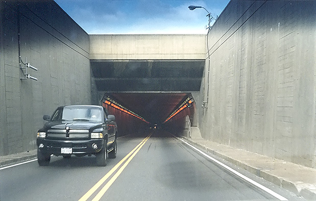 |
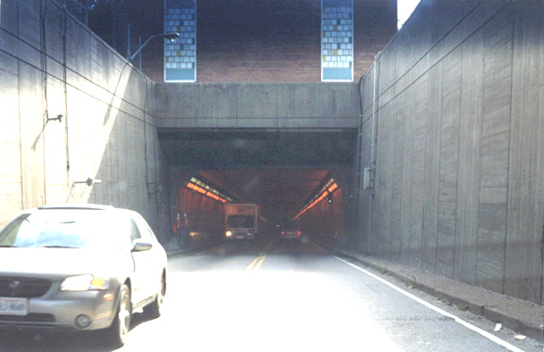
Midtown Tunnel southern portal. This tunnel has 2 lanes (one each way) and it was opened to traffic in 1962. Notice the high intensity orange lights that help motorists' eyes transition from the outdoors to the standard fluorescent lighting in most of the tunnel. Photo taken on October 2, 2004. |
| The following 7 photos comprise in order a drive southbound from the Midtown Tunnel to the VA-164 Western Freeway westbound. | |
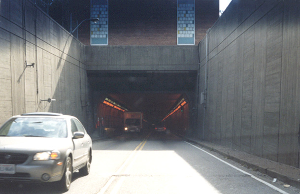 |
Midtown Tunnel northern portal. This tunnel has 2 lanes (one each way) and it was opened to traffic in 1962. Notice the high intensity orange lights that help motorists' eyes transition from the outdoors to the standard fluorescent lighting in most of the tunnel. Photo taken on October 2, 2004. Brighter image. |
 |
US-58 MLK Freeway 2-lane southbound roadway from the Midtown Tunnel. |
 |
US-58 MLK Freeway 4-lane southbound roadway from Midtown Tunnel, the ramp to the right carries the 2-lane high-speed roadway that connects the Midtown Tunnel to the VA-164 Western Freeway, and the ramp to the left carries the 2-lane high-speed roadway that connects the Midtown Tunnel to the MLK Freeway. |
 |
VA-164 westbound 2-lane high-speed roadway that connects the Midtown Tunnel to the VA-164 Western Freeway westbound. This ramp is easily drivable at 45 mph. |
 |
VA-164 westbound 2-lane high-speed roadway that connects the Midtown Tunnel to the VA-164 Western Freeway westbound. The high chain link fencing is on the bridge sections that pass over the Portsmouth Marine terminal. |
 |
VA-164 westbound 2-lane high-speed roadway that connects the Midtown Tunnel to the VA-164 Western Freeway westbound. Merging in on the left is the 2-lane roadway ramp that connects the US-58 MLK Freeway northbound to the VA-164 Western Freeway westbound. |
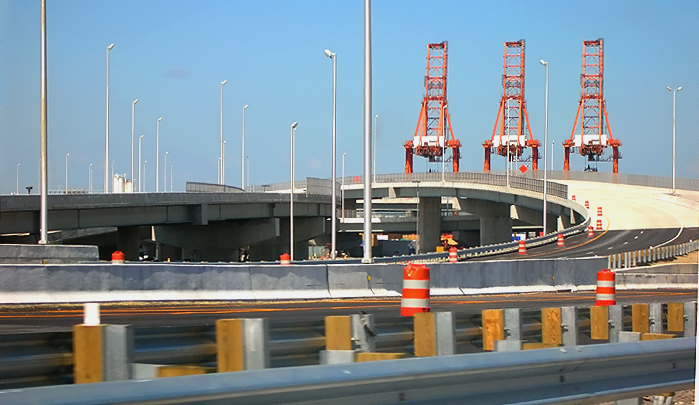 |
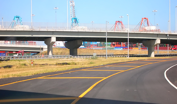
In the distance, the 2-lane roadway ramp that connects the US-58 MLK Freeway northbound to the VA-164 Western Freeway westbound. The bridged roadway is the top level of the 3-level Pinners Point Interchange, and it passes over the Portsmouth Marine Terminal. The gantries at the Portsmouth Marine Terminal are visible. |
| The following 5 photos comprise various views of Bayview Boulevard and the Port Norfolk Connector bridge in the Port Norfolk neighborhood. | |
 |
Work on Bayview Boulevard, formerly the arterial connector to the former east end of the West Norfolk Bridge, has been completed. This waterfront road was reduced from 4 lanes to 2 lanes, repaved, and the roadsides nicely landscaped and a pedestrian/bicycle trail built alongside the road, and the pedestrian/bicycle trail has a bridge to the West Norfolk Bridge so that pedestrians and bicyclists can utilize the north shoulder of the bridge to cross the river. Bayview Boulevard is now a quiet residential street with neighborhood traffic only. |
 |
Bayview Boulevard, similar vantage point as previous photo, taken with telephoto lens. The Port Norfolk Connector bridge is visible ahead, and the gantries at the marine terminal. |
 |
Bayview Boulevard in foreground, the Port Norfolk Connector bridge is visible ahead. |
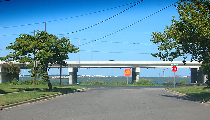 |
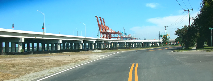
Looking north, from Maryland Avenue with its intersection with Bayview Boulevard in the Port Norfolk neighborhood just ahead, and the Elizabeth River and Port Norfolk Connector bridge beyond. Most of the river view still exists between the bridge piers and the bridge superstructure, and the freeway roadway is 33 feet above river mean high water level, and the bridge is about 400 feet offshore at this point. |
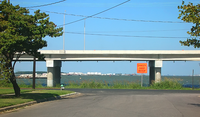 |
Looking north, from Maryland Avenue with its intersection with Bayview Boulevard in the Port Norfolk neighborhood just ahead, and the Elizabeth River and Port Norfolk Connector bridge beyond. The view out into the river is mainly that of an industrial harbor. |
| These 8 photos comprise in order a drive northbound on the MLK Freeway to the Midtown Tunnel. | |
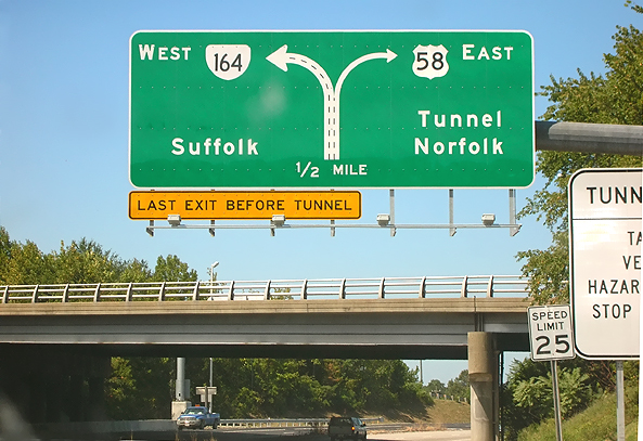 |
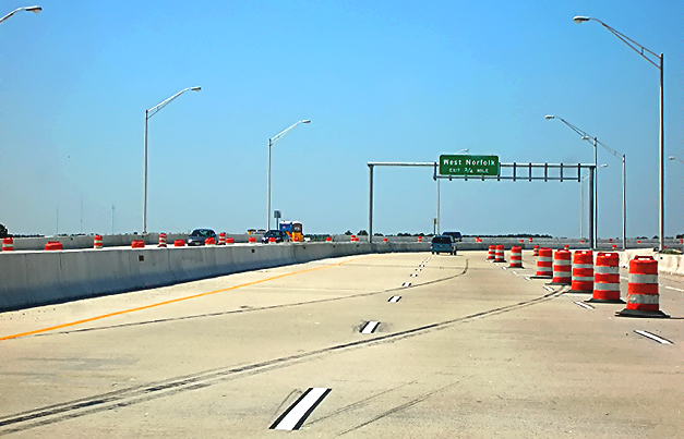
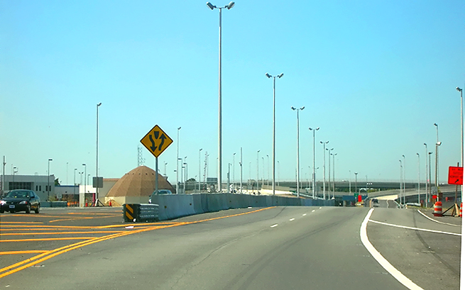
US-58 Martin Luther King Freeway, driving northbound, approaching the VA-141 London Boulevard overpass bridge. The diagrammatic sign for the Pinners Point Interchange, was just erected. |
 |
US-58 MLK Freeway, driving northbound, passing over bridge over Cleveland Street. The 4-lane MLK Freeway has been reconstructed to 6 lanes, with a concrete median barrier. At this section the MLK Freeway northbound splits, with the 2 right lanes heading to the US-58 Midtown Tunnel approach highway, and with the 2 left lanes heading to the VA-164 Western Freeway. The 2-lane roadway to the Midtown Tunnel approach highway, has the left lane closed via yellow paint lines, and the second lane on this ramp will remain closed until the parallel Midtown Tunnel is built in the future. |
 |
US-58 MLK Freeway, driving northbound, with 2 lanes heading to the Midtown Tunnel. The 2-lane roadway to the US-58 Midtown Tunnel approach highway, has the left lane closed via yellow paint lines. |
 |
US-58 MLK Freeway, driving northbound, with 2 lanes heading to the Midtown Tunnel approach highway. The 2-lane roadway to the Midtown Tunnel, has the left lane closed via yellow paint lines. The bridge ahead is the 2-lane roadway ramp from the VA-164 Western Freeway to the Midtown Tunnel approach highway. This ramp is easily drivable at 45 mph. |
 |
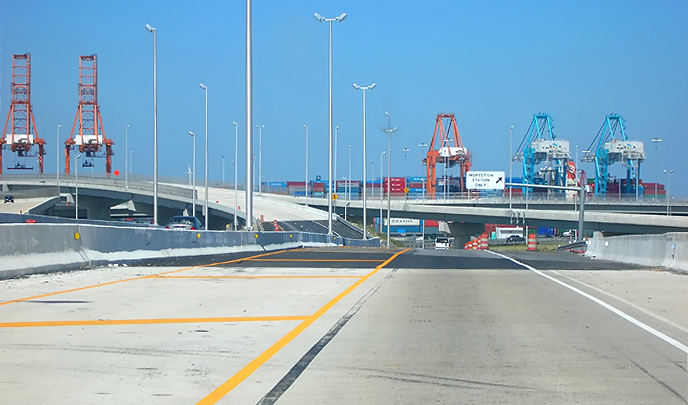
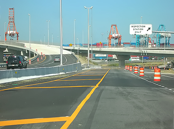
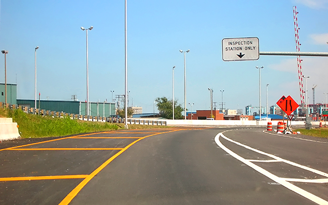
US-58 MLK Freeway, driving northbound, with 2 lanes heading to the US-58 Midtown Tunnel approach highway. The 2-lane roadway to the Midtown Tunnel, has the left lane closed via yellow paint lines. The bridge ahead is the 2-lane roadway ramp from the VA-164 Western Freeway to the Midtown Tunnel approach highway. The small building on the bridge is for the inspector for the tunnel truck inspection station. |
 |
US-58 MLK Freeway, driving northbound, with 2 lanes heading to the US-58 Midtown Tunnel approach highway. The 2-lane roadway to the Midtown Tunnel, has the left lane closed via yellow paint lines. |
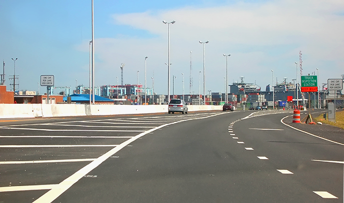 |
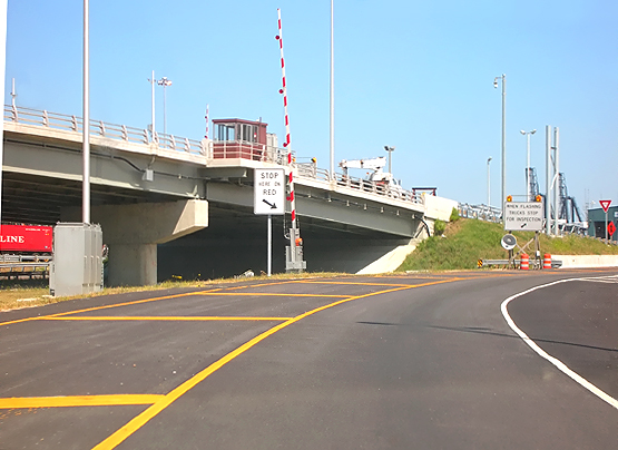
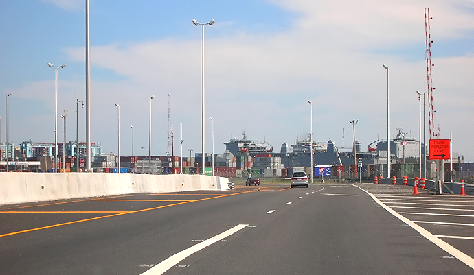
US-58 MLK Freeway, driving northbound, with 2 lanes heading to the US-58 Midtown Tunnel approach highway. The 2-lane roadway to the Midtown Tunnel, has the left lane closed via paint lines. The area to the right is the tunnel truck inspection station. |
 |
Reconstructed approach highway to the Midtown Tunnel. The roadway design has 3 lanes narrowing down to 2 lanes, with the VA-164 roadway merging into the US-58 MLK roadway, but have permanent line painting for one lane on each, since all that merges into one northbound lane through the tunnel; and those second lanes will remain closed until the parallel Midtown Tunnel is built in the future. |
| The following 7 photos comprise in order a drive southbound on the MLK Freeway from the Midtown Tunnel approach highway. | |
 |
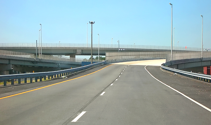
US-58 MLK Freeway 4-lane southbound roadway from Midtown Tunnel, the ramp to the right carries the 2-lane high-speed roadway that connects the Midtown Tunnel to the VA-164 Western Freeway, and the ramp to the left carries the 2-lane high-speed roadway that connects the Midtown Tunnel to the MLK Freeway. The highest overpassing bridged roadway is the top level of the 3-level Pinners Point Interchange, the 2-lane roadway ramp that connects the MLK Freeway northbound to the VA-164 Western Freeway westbound. |
 |
US-58 MLK Freeway 2-lane southbound roadway from Midtown Tunnel, this Pinners Point Interchange ramp carries the 2-lane high-speed roadway that connects the Midtown Tunnel to the MLK Freeway. The overpassing bridged roadway is the 2-lane roadway ramp that connects the VA-164 Western Freeway eastbound to the Midtown Tunnel approach highway. This roadway is easily drivable at 45 mph. |
 |
US-58 MLK Freeway 2-lane southbound roadway from Midtown Tunnel, this Pinners Point Interchange ramp carries the 2-lane high-speed roadway that connects the Midtown Tunnel to the MLK Freeway. The overpassing bridges carry the roadways between the MLK Freeway and the VA-164 Western Freeway. |
 |
US-58 MLK Freeway 2-lane southbound roadway from Midtown Tunnel, this Pinners Point Interchange ramp carries the 2-lane high-speed roadway that connects the Midtown Tunnel to the MLK Freeway. The overpassing bridges carry the ramps between the MLK Freeway and the VA-164 Western Freeway. |
 |
US-58 MLK Freeway 2-lane southbound roadway from Midtown Tunnel, this Pinners Point Interchange ramp carries the 2-lane high-speed roadway that connects the Midtown Tunnel to the MLK Freeway. |
 |
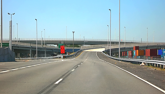
US-58 Martin Luther King Freeway, 4 lanes southbound, passing over the bridge over Cleveland Street, after the merge between the VA-164 Western Freeway and the MLK Freeway. The MLK Freeway southbound tapers to 3 lanes as it heads to VA-141 London Boulevard. |
 |
Martin Luther King Freeway bridge over Cleveland Street. The bridge has 4 lanes each way, and it passes over two local roads and a railroad line. |
Lead article Parallel Midtown Tunnel / Pinners Point Interchange / Martin Luther King Freeway Extension
All photos by Scott Kozel.
Copyright © 2005 by Scott Kozel. All rights reserved. Reproduction, reuse, or distribution without permission is prohibited.
By Scott M. Kozel, Roads to the Future
(Created 10-1-2005, files moved to pennways on 5-1-2006)