
| DE Route 1 - Korean War Veterans Highway |
| DE Route 1 - Korean War Veterans Highway |
Delaware Route 1, the Korean War Veterans Memorial Highway, is a 51-mile-long limited access highway built to full Interstate standards, and it parallels US-13, between US-13 and Dover Air Force Base south of Dover, and I-95 in northern Delaware.
The table of contents below has internal links on this page to sections of this article. You can mouse click the link to go to that section, and hit the "Back" key on your browser to return to the table of contents.
Introduction
U.S. 13 Relief Route
Delaware Route 1 C & D Canal Bridge
US-13 St. Georges Bridge
Chesapeake and Delaware Canal (C & D Canal)
Section and Opening Summary
Traffic Volumes
Section Details
Early History
Historical Chronology
Future Plans
SR 1 Corridor Preservation Plan
Photos of DE-1 Superhighway
Links to My Related Articles
Links to External Websites
Credits
Delaware Route 1, the Korean War Veterans Memorial Highway, is a 51-mile-long limited access highway built to full Interstate standards, and it parallels US-13, between US-13 and Dover Air Force Base south of Dover, and I-95 in northern Delaware. The last section opened to traffic on May 19, 2003, a 8.9-mile-long section south of Odessa. The northern 1/4 of the highway is toll-free, and the southern 3/4 of the highway is tolled. The highway includes the signature cable-stayed bridge over the Chesapeake and Delaware (C & D) Canal near the town of St. Georges. The total cost of the new highway was almost $900 million, and that includes the costs of engineering, right-of-way, and construction. The highway has 4 lanes between I-95 and US-13 at Tybouts Corner, and it has 6 lanes between US-13 at Tybouts Corner and just south of the C & D Canal Bridge, and 4 lanes south of there to Dover Air Force Base, with a 4-lane connector from DE-1 to US-13 south of Dover. The highway's planning, design, construction and maintenance is administered by the Delaware Department of Transportation (DelDOT).
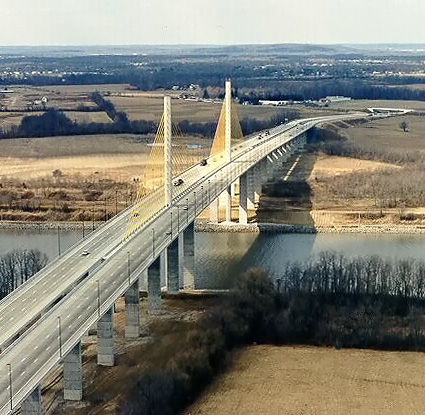
DE-1 C & D Canal Bridge. Looking northbound, photo taken February 1996 by DelDOT. Photo image cropped by Scott Kozel.
State Route 1 - Korean War Veterans Memorial Highway - DelDOT has an excellent website about this highway. There are lots of details about the planning, design, cost, and construction of the various sections of the highway, along with many photos of the construction. I'll point the reader to this website, as it is very comprehensive. My article will highlight the things that I want to provide special emphasis on.
From the DelDOT webpage. Quoted in blue text:
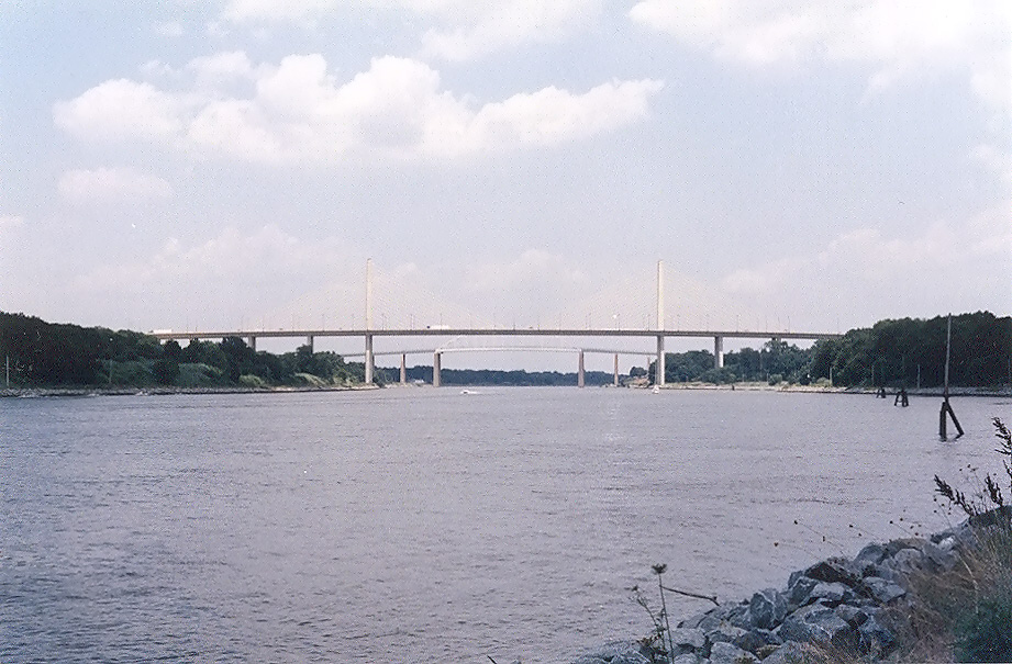
Above: The DE-1 C & D Canal Bridge to the left, and the US-13 St. Georges Bridge to the right. Looking northbound, photo taken October 1997, by DelDOT. Photo image cropped by Scott Kozel.
DelDOT called this highway the “U.S. 13 Relief Route” from its planning stages beginning in 1983, until it was officially named the Korean War Veterans Memorial Highway in 2003. The highway itself never did have “Relief Route” designation signs posted on the highway, and the various sections were designated as DE-1 when they opened. The highway is seldom referred to as the Relief Route anymore, and certainly not officially. I will generally refer to it in this article as the DE-1 superhighway, to distinguish the new freeway from the older 4-lane arterial highway sections of DE-1 that continue from the southern end of the new freeway, to the Atlantic Ocean beach towns in southern Delaware.
The DE-1 superhighway had its origins in the planning for the North-South Extension of the Delaware Turnpike from 1971-78. That proposal was rather controversial with regard to the communities involved and the environmental concerns. The Turnpike extension was planned to parallel US-13, much like today's new road.
DelDOT began developing a new proposal, starting in 1985. This proposal qualified as one of six 1987 Federal Highway Administration (FHWA) demonstration projects where, for the first time, federal-aid highway funds were allowed to be mixed with toll revenue bond financing on new highways. This would allow a new highway to draw funds from both sources, significantly reducing toll rates and bond amortization time. The total mainline toll for the DE-1 superhighway is $2.00, which is inexpensive by today’s standards for new toll roads, just 3.9 cents per mile if figured over the whole 51 miles. Electronic open-lane (full-speed mainline highway) toll collection is available through EZ-Pass.
I wrote this (now italicized) in my original website article about this highway, when I created the article in August 1997: DelDOT called the road the "U.S. 13 Relief Route" since it was intended not only to provide a bypass of heavily-traveled US-13, but also to relieve traffic. My personal opinion is that the road is similar to the original proposed turnpike extension, but marketed in a much better fashion. DelDOT throughout the process has held regular, in-depth community involvement workshops to develop the various portions of the expressway. They are carefully addressing environmental concerns in the various watercourse areas, and they are carefully addressing historical site concerns. I think the very name "Relief Route" is a brilliant name to use, since the name depicts not a bland concrete expressway, but a friendly road that causes Delawareans to smile and breath a sigh of relief when they think about the expressway's ongoing development, and ensuing traffic improvements. Marketing is very important for an organization.
Now that the “Relief Route” is completely open to traffic, I would surmise that DelDOT no longer needs the marketing aspect of that name! Actually, an Internet search reveals many roads around the world called “Relief Route”, so it is not an uncommon name. The term “relief route” implies a highway that supplements the highway that it “relieves”, and would imply a highway of the same functional class or of a lower functional class, in that it wouldn’t replace the function of the older highway, it would just provide relief to it. That really never was the case, though, since US-13 is (and was back in 1985 as well) a 4-lane divided highway that is mostly comprised of high-speed 55-mph segments, and to a lesser degree comprised of various urban segments with many traffic signals and lower speed limits in the ranges of 45-mph and 35-mph. The DE-1 superhighway from its inception in planning back in the 1980s, in a functional sense, would be similar to the many places in the U.S. where an Interstate highway or other freeway was built parallel to a major primary highway, with the intent being that the new freeway would replace the long-distance traffic function and the interregional traffic function of the older highway, thus relegating the older primary highway to a local traffic role. That is exactly the case with the DE-1 superhighway, as it handles the long-distance traffic function and the interregional traffic function in the Wilmington-Dover corridor, and US-13 has the local traffic function in that corridor, although since US-13 is a 4-lane divided highway, it will function quite well for a long time to come as a local highway.
The first major DE-1 superhighway milestone was the circulation of the Draft Environmental Impact Statement (DEIS) and the first Public Hearings were held on December 2-4, 1985. On July 23, 1987, the Federal Highway Administration (FHWA) gave Location Approval to the route. In early 1990, the decision was made to pave the mainline of the highway with Portland cement concrete pavement, with bituminous concrete pavement (asphalt or hotmix) on the shoulders and side roads. The total tonnage quantity of each for the entire corridor is about 55% concrete and 45% hotmix. The first construction started in early 1990 near Smyrna, and at that point the cost estimate for the entire route was $500 million.
From the beginning, DelDOT has published periodic newsletters about the project. In Summer 1989 a revised format came forth, called "On the Road", subtitled "The Relief Route - SR 1". It was published several times per year. I have most of the publications published from the beginning of the project, and most of my information comes from them. The DelDOT website now has nearly all of the newsletters on their website in .pdf Abobe format, on the webpage State Route 1 - Newsletters.
A number of posters in the Usenet newsgroup misc.transport.road have suggested designating this highway as Interstate Route I-99 when complete. I think that is a good idea, since a logical future Interstate corridor would run from I-95 near Wilmington, Delaware, to I-64 in Norfolk, Virginia, and the number 99 would fit into the Interstate numbering scheme.
Delaware Route 1 C & D Canal Bridge
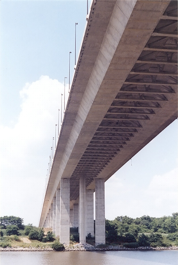
The DE-1 C & D Canal Bridge is a cable-stayed bridge. It is 4,498 feet long, has six lanes, and the main span has 145 feet of vertical navigational clearance above the average high tide water level, and 750 feet of horizontal navigational clearance. The C & D Canal bridge main span completely crosses the canal, and this was done to make it impossible for a ship to hit a bridge pier and bring the bridge down. The northbound and southbound roadways each have three 12-foot-wide lanes with 10-foot-wide left and right shoulders. The design is such that if one roadway has to be closed for maintenance, the other could temporarily carry four lanes (2 each way). The design is also convertible to eight lanes, by simply restriping the roadways. One construction contract for the entire bridge substructure and superstructure and was awarded on April 1, 1992, at $57.9 million (well under the engineering estimate), and the bridge opened to traffic in December 1995, with the final contract cost at the end of the project's construction tallying to $57,782,823.33. (Contract award and final costs are always to the penny, but I often round the number to 3 places for simplicity).
Crossing The Delaware - The beautiful DE-1 C & D Canal signature bridge is detailed in an excellent website article by the Federal Highway Administration. It takes a while to load on a dialup modem, because it has a lot of images, but it is well worth the wait.
C & D Canal Bridges - my article with 3 aerial photos of the DE-1 and US-13 C & D Canal bridges at St. Georges.
The cable-stayed design, when utilized on a medium-length main bridge span, is often less expensive to build than the older suspension and cantilever designs. DelDOT and USACE got a lot for their money on the C & D Canal bridge. Cable-stayed bridges were still a relatively recent advent in the U.S. when this bridge was built, with less than 10 such bridges built at that point. The C & D Canal Bridge is actually two bridge roadway structures side-by-side, with one set of center pylons between the two bridges and one set of common stays that supports both roadway structures. The bridges piers, pylons, and roadway structures were all built by the segmental pre-cast post-tensioned construction method. These reinforced concrete segments were built in a fabrication yard, and then trucked to the bridge construction site. The segments were assembled on the bridge, glued together with grout, and then longitudinal steel cables were connected through multiple longitudinal channels inside the series of segments, and then the steel cables were post-tensioned so that the end result was structurally the same as if the whole structure was one solid unit.
The DE-1 C & D Canal Bridge is very similar to the I-295 Varina-Enon Bridge near Richmond, Virginia. Both bridges have the cable-stayed design with center pylons and twin roadway structures, both utilized the segmental pre-cast post-tensioned construction method, both have the same number of lanes, both have full right and left roadway shoulders, each has almost the same navigational clearances, and each has almost the same overall length.
Richmond-Petersburg Turnpike (I-95/I-85) and I-295 - my article that includes details and photos of the I-295 Varina-Enon Bridge.
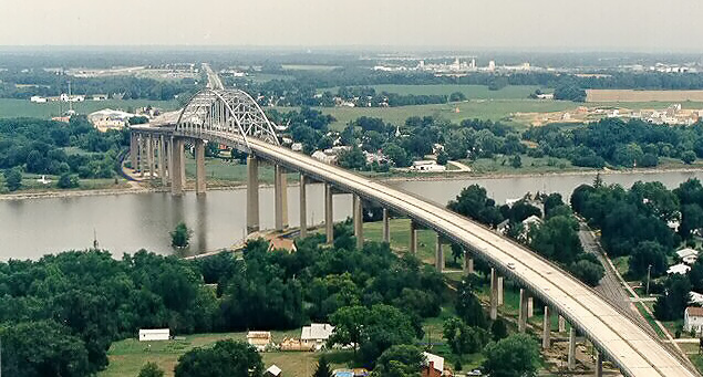
US-13 passes over the C & D Canal on a fixed high-level bridge that has 135 feet of vertical navigational clearance above the average high tide water level, and the bridge was opened to traffic in 1943. Given its age and its being paralleled by the new DE-1 C & D Canal Bridge about 1/2 mile to the west, DelDOT considered a plan to close and remove the US-13 St. Georges Bridge after the new DE-1 bridge opened.
St. Georges Bridge, 4-lane US-13. Looking northbound, taken August 1997, by DelDOT. Photo image cropped by Scott Kozel.
I wrote this (now italicized) in my original website article about this highway, when I created the article in August 1997: The Summer 1997 "On the Road" newsletter issue concerns the US-13 St. Georges Bridge over the C & D Canal. It is a high-level fixed crossing that was completed in 1943 by the U.S. Army Corps of Engineers when the canal was widened and deepened. The new DE-1 C & D Canal Bridge opened nearby in December 1995, and the age and condition of the old bridge has led to debate about whether it should be removed. If retained, it will need about $30 million worth of rehabilitation to continue to carry four lanes of unrestricted traffic. The "On the Road" newsletter says that the corridor local and through traffic in the St. Georges area will be 88,000 vehicles per day (VPD) by 2018, reaching the capacity of the new bridge. The current recommendation is to retain the US-13 bridge. The local people want it to stay open so that they can cross the canal without using the expressway.
This issue has been resolved in favor of keeping the US-13 St. Georges Bridge in service. Based on the projected traffic data above, I think that is a good idea. Local traffic access to the south approach of the DE-1 C & D Canal Bridge is just about as convenient as local traffic access to the south approach of the US-13 C & D canal bridge, as there are northerly local ramps that connect to DE-1 a few hundred feet south of the C & D Canal Bridge. However, local traffic access to the north approach of the DE-1 C & D Canal Bridge is not nearly as convenient, as the closest local DE-1 interchange north of the canal necessitates a trip of over 3 miles for someone in St. Georges north of the canal to cross the C & D Canal, and vice versa.
So there are several reasons that together provide warrants for keeping the US-13 canal bridge open to traffic, ease of local motorized vehicular access between the two portions of the town of St. Georges on either side of the canal, and future capacity in the north-south highway corridor at St. Georges beyond 2018.
Keeping US-13 at 4 lanes or more throughout the corridor where it was bypassed by the DE-1 Korean War Veterans Highway, I think will be smart from a future perspective of maximizing the ability of US-13 to handle the local traffic, so that the DE-1 superhighway can keep adequate capacity for its function for long-distance and interregional traffic. This will also help for incident management on DE-1, if part of the highway is temporarily closed due to a traffic accident; even though US-13 would struggle to handle the detoured traffic, it would still provide a reasonable alternate during the timespan of the incident.
This is from the DelDOT website article "State Route 1 - Chesapeake
and Delaware Canal Bridge to Tybouts Corner" in June 2003 (blue text):
During the planning and development
of State Route 1, it was determined that a new bridge over the C & D Canal was
needed. Through analysis of several alternatives and extensive public involvement,
it was determined that the best location for the new bridge would be west of the
St. Georges Bridge. All along this project's timeline, there has been a debate
as to the fate of the old St. Georges Bridge: who would be responsible for its
upkeep if it were to remain; and how would the residents of St. Georges, whose
town is split in half by the C & D Canal, be able to easily get from one side
to the other if the bridge was dismantled. It so happens the St. Georges Bridge
recently underwent a major facelift. Its 4-lanes handle traffic for St. Georges,
and those heading toward State Route 7. The 6-lane C & D Canal Bridge, or the
Route 1 Bridge, carries traffic from State Route 1 northward toward Wilmington
and I-95. US13 may also cross over to the new bridge to reach points north.
St. Georges Bridge - this is from the USACE website with a June 2002 publish
date (blue text):
The St. Georges Bridge is a fixed, high-level, four-lane highway bridge
that carries U.S. Route 13 over the Chesapeake and Delaware Canal at
St. Georges, Del. Completed in 1942, it is owned and operated by the U.S.
Army Corps of Engineers.
In December 1995, the Delaware Department of Transportation opened to traffic a replacement bridge to carry State Route 1 across the C&D Canal approximately 1,800 feet west of the St. Georges Bridge. The replacement bridge was authorized by Congress under the Water Resources Development Act of 1990, and the state was reimbursed by the federal government for the cost of design and construction.
After the opening of the new bridge, the Corps of Engineers prepared a study on alternatives for disposing of the old St. Georges Bridge. As a result of the study, the Army then directed the Corps to close the bridge effective July 1997 and proceed with plans to remove it. The closure did not take place, however, and Congress has since passed legislation that effectively placed all such activities on hold until further traffic studies could be completed.
Because of an increased incidence of lead paint chips flaking off the old bridge, in early 2001 the Corps began a $10 million project to remove all lead-based paint from the bridge and repaint it to protect against further oxidation. The contract is currently on schedule for completion in June 2002.
In coordination with the State of Delaware's Department of Natural Resources and Environmental Control, the Corps also conducted two rounds of soil testing on properties under and near the bridge in both North and South St. Georges. Then in November 2001, DNREC and the Corps agreed to work cooperatively to conduct (1) additional investigation of previously tested residential properties in St. Georges and 60 others that had not been tested to date and (2) initial remediation at 12 properties identified as containing the highest levels of contamination. The remediation is scheduled to begin in mid-June 2002.
More news links are on the above link.
Converting to unleaded - Repainting the St. Georges Bridge - USACE article about the bridge repainting project.
Chesapeake and Delaware Canal (C & D Canal)
The 14-mile long Chesapeake and Delaware Canal (C & D Canal) crosses the northern Delaware/Maryland peninsula, and its eastern mouth is at Reedy Point, Delaware, on the Delaware River, with its western mouth at Chesapeake City, Maryland, on Chesapeake Bay. The name of the canal reflects the names of the two water bodies that it connects.
This canal is a very interesting facility. I read a book about the canal years ago, and it said that it is one of the few fully sea-level shipping canals in the world. The original C & D Canal was built privately in the 1820s, it had 10 feet of water depth, and it had four locks and it carried barges and sailing vessels that were towed by teams of mules and horses. These stated channel depths are as measured below the average low tide water level. The canal was purchased by the U.S. government in 1919, and there were several expansions of the canal by the U.S. Army Corps of Engineers (US ACE) over the years. In the 1920s, the canal was excavated and deepened to create a sea-level facility with a channel 12 feet deep and 90 feet wide, with no locks, completed in 1927. From 1935 to 1938, the canal channel was deepened to 27 feet of water depth and widened to 250 feet, with another project to provide same-draft access to the C & D Canal from Chesapeake Bay, which expanded a federal navigation channel for 26 miles, to 27 feet deep and 400 feet wide.
By the mid 1970s, further deepening/widening projects increased the channel depth to 35 feet of water depth, with the channel width increased to 450 feet, which is adequate for two-way traffic for most oceangoing ships. The upper Chesapeake Bay dredged channel was also deepened to 35 feet deep, in conjunction with the last set of projects. Even though Delaware is relatively flat, the canal did cut through a "ridge" about 60 feet above sea level, and the last expansion project required an enormous amount of excavation. The C & D Canal provides a shortcut of about 300 miles for ship traffic between the Port of Baltimore, and the northeastern U.S. cities and Europe. The C & D Canal is listed on the National Register of Historic Places, and it is designated as a National Historic Civil Engineering and Mechanical Engineering landmark. The C & D Canal is the only major commercial canal in the U.S. that is still in use, among those which were built during the heyday of canal building in the early 1800s. The C & D Canal is also the site of 6 large bridges that were built for the specific purpose of crossing the canal with 5 highway crossings and 1 railroad crossing.
Chesapeake and Delaware Canal (C & D Canal) - My article with more details about the C & D Canal. It has links to other C & D Canal websites, including the official US ACE C & D Canal website.
DE-1 Korean War Veterans Highway sections presented in chronological opening order:
The Route 7 Relocation connects the I-95/DE-7 interchange, parallels DE-7, and connects into US-13 near Red Lion. It is 6 miles long, it has 4 lanes, and it was completed in three sections, in August 1991, November 1991, and April 1993. It was designated DE-1 when it opened.
The Smyrna-Dover Bypass passes east of Smyrna and Dover, is 18.3 miles long, 4 lanes wide, and it opened Dec. 21, 1993.
The St. Georges Bypass with the new C&D Canal Bridge, is 6.6 miles long, 6 lanes wide, and it opened in December 1995.
The section of DE-1 from the St. Georges Bypass to south of Odessa, including the Odessa Bypass, is 7.2 miles long, 4 lanes wide, and it opened in November 1999.
The section of DE-1 at Dover Air Force Base involved upgrading the existing US-113 to 4-lane freeway standards, and it is 2.1 miles long, and it was completed in two sections, in December 1998 and in July 2000.
The Puncheon Run Connector is a 2.3-mile-long 4-lane connector from US-13 south of Dover to the new DE-1, and it opened in December 2000.
The section of DE-1 from south of Odessa to the north end of the Smyrna Bypass, is 8.9 miles long, 4 lanes wide and it opened in May 2003, completing the DE-1 superhighway.
The DE-1 annual average daily traffic (AADT) figures for 2002 from DelDOT are on the following webpage, and the AADT ranges from 28,362 at the beginning of the DE-1 superhighway south of Dover, to 33,075 at Exit 114 U.S. 13 at S. Smyrna, to 58,153 on the C & D Canal Bridge, to 68,063 at Exit 165A/B Interstate 95. See: SR-1 Turnpike by AARoads.
DE Route 1 - Section Details - My article with more details about the sections of Delaware Route 1, the Korean War Veterans Memorial Highway; with descriptions, lengths, construction details, contract costs, and opening details.
The US-13 Dover Bypass was completed in 1952, and it didn't take long for it to develop into a congested commercial strip of fast-food restaurants, gas stations and other businesses strung along US-13. The bypass is a 4-lane divided highway, but it does not have access controls, so there was nothing to prevent the eventual development of businesses, homes, and housing subdivisions along the highway, with driveway access; and all intersections were at-grade, so eventual heavy cross-traffic necessitated the installation of numerous traffic signals in many places.
A study in 1958 was performed to determine the best route for a limited-access highway between south of Dover and Frederica, and the recommendation was to build a completely new highway, but nothing transpired with it except for the Frederica bypass on US-113.
The next 25 years saw nine efforts to study the possibility of a new Dover bypass or a north-south new highway to relieve traffic on US-13, but all of these studies came to naught, because of various political problems and citizen opposition.
A map of the DE-1 superhighway reflects the political minefields that were successfully sidestepped in the Relief Route studies, and that is why the highway criss-crosses back and forth across US-13.
The DelDOT approach with the Relief Route was to go to the public for the first series of meetings without any lines on a map. The study team of engineers, consultants, historians, environmentalists and others studied a huge map of the US-13 corridor, looking at the best way to cross the C & D Canal, bypass Smyrna and Dover, avoid wetlands, and reduce the impact on farmland. Three principal alternatives evolved from that, a railroad (Conrail then, CSXT today) paralleling alignment to the west, a near east route paralleling mostly just to the east of US-13, and the conversion of the existing US-13 into a freeway with service roads (this third alternative was considered unworkable from the beginning by the planners, but DelDOT did that to show good faith with the farmers).
When the alternatives were narrowed to three, the next series of public meetings began. The final Relief Route alignment, selected in 1986, did not choose any of the three alternatives exclusively, although from Smyrna south it follows the near east route.
Source, and more details – DelDOT webpage Road to Relief - 25 years of failures.
This covers the timespan from the opening of the original Dover Bypass to the completion of the DE-1 superhighway.
From the DelDOT webpages
Road to Relief - Nine studies later...a history and
State Route
1 -Project Timeline. Quoted in blue text:
1952 -- The original Dover
bypass opens, but rapidly develops with strip commercial development.
1958 -- Study by DeLeuw, Cather and Brill recommends six alternatives for a limited
access highway south of Dover to Frederica. Frederica bypass is constructed on
a portion of one of the recommended routes.
1964 -- Dover Area State Planning Study concludes that new growth can be expected
west and south of the city and recommends the construction of a limited-access
bypass west of Dover.
1966 -- At a public hearing in Dover, objections are raised by businesses and
farmers to a western bypass of the city.
1967 -- A study on the economic and social effects of the proposed bypass concurs
with the concept of a western bypass and says the loss of farms to urban development
is a natural free-market trend.
1967 -- State highway department issues a resolution approving the location of
the west Dover bypass.
1968 -- Study by DeLeuw, Cather and Associates recommends a western alignment
for a Dover bypass and proposes a 19.5-mile limited access highway with seven
interchanges.
1969 -- Dover Planning Commission approves a west Dover bypass. At a public hearing,
extensive opposition is raised by agricultural organizations. The notion that
future growth would occur mostly to the west of Dover is challenged. A study by
Knoerle, Bender, Stone and Associates recommends a north-south toll road network
with east-west links, but a governor's committee declares it unworkable.
1970 -- A Delaware State North-South Corridor Route Study analyzes six alternatives
and recommends a revised western alignment because of its more minimal farmland
requirements.
1971 -- Kent County's new comprehensive plan recommends a westerly Dover bypass.
A study by Michael Baker Jr. Inc. recommends a free, 34-mile north-south highway
from Tybouts Corner south, with an easterly bypass of Smyrna and a westerly bypass
of Dover.
1971-1978 -- Studies for North-South Extension of the Delaware Turnpike.
1974 -- Another DeLeuw, Cather study conducts an extensive analysis of a north-south
divided highway to the west of U.S. 13 and recommends that it be a toll road.
1979 -- A study by Howard, Needles, Tammen and Bergendoff evaluates all studies
to date, including eight alignments ranging from far west to far east. It recommends
a near west bypass of Dover.
1979 -- The North-South Road Study Committee recommends the construction of a
new north-south limited-access freeway to Gov. Pierre S. du Pont.
[the following entries refer to the US-13 Relief
Route / DE-1 Korean War Veterans Highway]
1983 -- US Route 13 Relief
Route Study Begins.
1984 -- Transportation secretary Kermit H. Justice announces to the General Assembly
that the department will undertake a U.S. 13 relief route project, and public
workshops begin.
October 1985 -- Draft Environmental Impact Statement (EIS) - three corridor alternatives
and combinations evaluated.
1986 -- The alignment of the U.S. 13 relief route is announced. It will feature
an upgrade of U.S. 13 in the Odessa area and a near-east bypass of Smyrna and
Dover. The route is modified somewhat afterward.
June 1987 -- Final Environmental Impact Study Approved - project staged to address
safety/congestion/funding.
July 1987 -- Tybouts to Christiana Mall/I-95 construction begins: Segment 1 -
US 40 to State Route 273.
March 1988 -- Tybouts to Christiana Mall/I-95 segment two construction begins
- US 13 to U.S. 40.
August 1988 -- Dover to Smyrna groundbreaking, 5 road relocations/bridge contracts,
4 mainline contracts.
August 1990 -- Tybouts to Christiana Mall/I-95 segment three construction begins
- State Route 273 to I-95.
August 1991 -- Tybouts to Christiana Mall/I-95 segment two opens (US13 to US40).
November 1991 -- Tybouts to Christiana Mall/I-95 segment one opens (US40 to State
Route 273).
April 1992 -- C & D Canal Bridge and Approaches groundbreaking, 1 canal bridge,
1 bridge/embankment, 1 mainline contract.
April 1993 -- Tybouts to Christiana Mall/I-95 segment three opens (State Route
273 to I-95).
December 1993 -- Dover-Smyrna Bypass opens.
December 1995 -- C & D Canal Bridge to Tybouts Corner opens.
February 1996 -- DAFB Main Gate Contract 1 groundbreaking - 1 of 2 mainline contracts
coordinated to maintain access/security and DAFB Housing Project.
May 1996 -- Odessa Bypass groundbreaking, 1 relocation, 3 mainline contracts.
October 1998 -- State Route 1, Puncheon Run Connector groundbreaking.
December 1998 -- DAFB Contract 1 completed.
March 1999 -- DAFB Main Gate Contract 2 groundbreaking - 2 of 2 mainline contracts
coordinated to maintain access/security and DAFB Housing Project.
November 1999 -- Odessa Bypass opens.
March 2000 -- Final State Route 1 groundbreaking: Smyrna to Odessa groundbreaking,
2 mainline contracts.
July 2000 DAFB -- Contract 2 completed.
December 2000 -- State Route 1, Puncheon Run Connector opens.
May 2003 -- Smyrna to Odessa opens.
September 2003 -- Total Project Completed.
The northern end of the DE-1 Korean War Veterans Highway, is the interchange between I-95 and DE-1. This interchange dates to at least the early 1970s, and it was originally built to connect I-95 to Delaware Route 7, and DE-7 was and is a local thoroughfare. This interchange has a modified cloverleaf design, adequate for connecting a freeway to a local thoroughfare, but inadequate for connecting one freeway to another freeway. DE-1 conceptually has a “T junction” with I-95, and the DE-1 freeway becomes the DE-7 thoroughfare north of I-95. DelDOT has a project in the works to properly connect DE-1 to I-95, with the construction of two new 2-lane high-speed semi-directional ramps, for the movement from DE-1 northbound to I-95 northbound, and the movement from I-95 southbound to to DE-1 southbound. The current interchange provides a freeway-design connection between the two freeways, but only from a technical standpoint. Several people who live in Delaware have told me that during peak traffic periods, that there are serious traffic backups for the movement from I-95 southbound to DE-1 southbound. The traffic movement from DE-1 northbound to I-95 northbound, is inadequate also. Interestingly, the I-95 southerly movements with DE-1 are not congested, according to these Delaware residents.
DelDOT
unveils I-95 construction plans, by
The News Journal, May 10,
2004, had an article about the proposed I-95/DE-1 interchange upgrade.
Excerpts (in blue text):
Excerpt for the northernmost 6 miles of the DE-1 superhighway, all the rest of the highway will be adequate for the traffic volumes for many, many years into the future beyond the 2003 completion year of this highway.
SR 1 Corridor Preservation Plan
The SR 1 Corridor Preservation Plan will preserve the 33 miles of existing 4-lane-divided DE-1, from Dover Air Force Base at the south end of the DE-1 superhighway, to US-9 near Lewes. This involves corridor protection by ensuring that enough land is available for service roads and interchanges, so the road can be upgraded to full freeway standards when it becomes necessary 15 or 20 years in the future. The concept is to preserve the existing capacity, by limiting the development along the highway. The segments that will see capacity improvements will most likely be those with signalized intersections with development, and stretches of highway with several driveways.
Following 8 photos by Scott Kozel, July 2003.
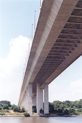 |
DE-1 C & D Canal Bridge, looking at the underside of the main span from the south shoreline of the C & D Canal. Large image (241 kilobytes) |
 |
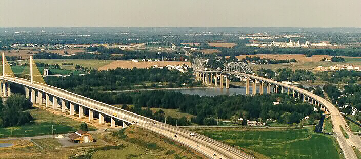
C & D Canal, near St. Georges, looking east from the south bank. This is a long range view of the two highway bridges at St. Georges, the DE-1 superhighway bridge in the foreground and the US-13 bridge in the background. Large image (241 kilobytes) |
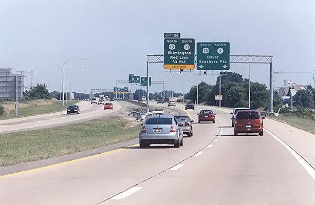 |
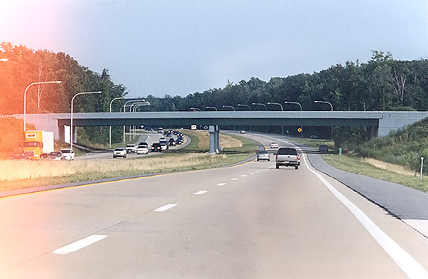
DE-1 superhighway, southbound near Tybouts Corner. |
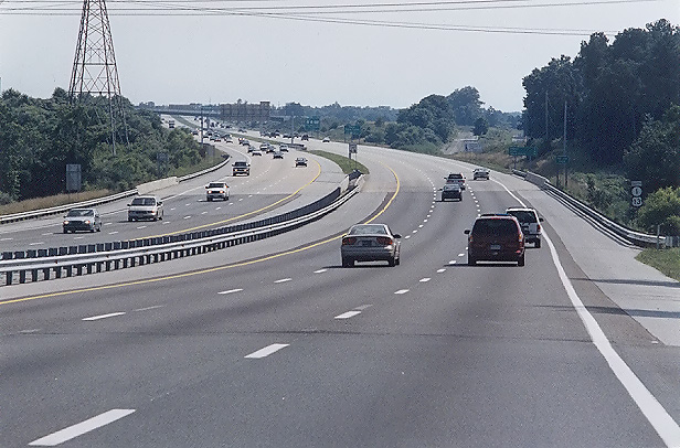 |
DE-1 superhighway, southbound, approaching Red Lion Creek Bridge. |
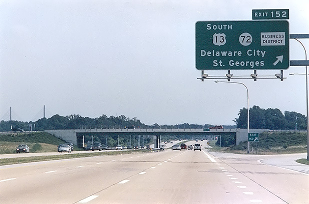 |
DE-1 superhighway, southbound, approaching DE-72 interchange near St. Georges. The two towers of the DE-1 C & D Canal Bridge are visible near the left edge of the photo. |
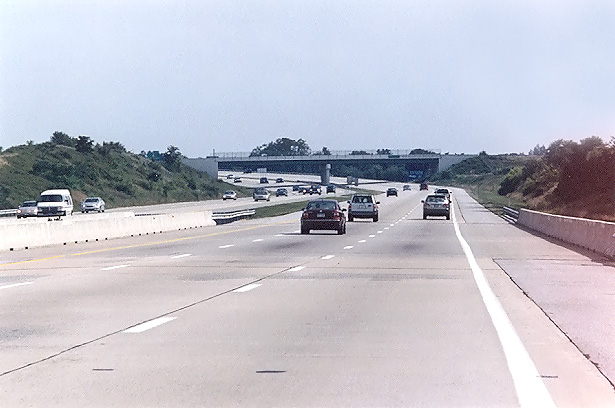 |
DE-1 superhighway, southbound, one mile north of the C & D Canal. |
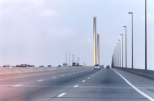 |
DE-1 C & D Canal Bridge, southbound, approaching the main cable-stay span, where the two towers are visible ahead. |
 |
DE-1 superhighway, northbound, near Townsend. |
DE Route 1 - Section Details - my article with more details about the sections of Delaware Route 1, the Korean War Veterans Memorial Highway; with descriptions, lengths, construction details, contract costs, and opening details.
C & D Canal Bridges - my article with 3 photos of the old and new C & D Canal St. Georges bridges.
Chesapeake and Delaware Canal (C & D Canal) - my article about the C & D Canal. It has links to other C&D Canal websites, including the official US ACE C & D Canal website.
Delaware Department of Transportation (DelDOT)
State Route 1 - Korean War Veterans Memorial Highway - DelDOT has an excellent website about this highway. There are lots of details about the planning, design, cost, and construction of the various sections of the highway, along with many photos of the construction. I'll point the reader to this website, as it is very comprehensive.
Relief Route - Route 1 by Dan and Jen Mengel.
SR-1 Turnpike by AARoads. Includes photos of the highway.
Korean War Veterans Memorial Highway-Relief Route (DE 1), of Philadelphia Area Roads, Crossings and Exits, by Steve Anderson.
Korean War Veterans Memorial Highway, of Delmarva Highways, by Cory Dukes. Includes photos of the highway.
Sources: DelDOT SR-1 website, FHWA C & D Canal Bridge website, DelDOT periodical "On the Road", Relief Route Environmental Impact Statement.
This article was created with the title "The Relief Route (Delaware Route 1)" on 8-14-1997, and the article received major updates and the title was changed to "DE Route 1 - Korean War Veterans Highway" on 7-1-2003. I changed the name of the article because the Relief Route name is no longer officially used in reference to this highway. Since the name "Korean War Veterans Memorial Highway" is a bit unwieldy to use in common speech and writing, I've taken my prerogative as a citizen journalist to shorten the name to "DE-1 superhighway" in many cases when I refer to it on my websites, since I want to distinguish the new freeway from the older 4-lane arterial highway sections of DE-1 that continue from the southern end of the new freeway to the Atlantic Ocean beach towns in southern Delaware.
Copyright © 1997-2010 by Scott Kozel. All rights reserved. Reproduction, reuse, or distribution without permission is prohibited.
By Scott M. Kozel, PENNWAYS, Roads to the Future
(Created 8-14-1997, last updated 7-5-2004, minor 5-30-2010)